Freston Circular
Suffolk Walk
County/Area - Suffolk
Author - Lou Johnson
Length - 6.6 miles / 10.7 km Ascent - 400 feet / 121 metres
Time - 3 hours 40 minutes Grade - easy/mod
Maps 

| Ordnance Survey Explorer 197 | Sheet Map | 1:25k | BUY |
| Anquet OS Explorer 197 | Digital Map | 1:25k | BUY |
Walk Route Description
Click image to see photo description.
Circular walk exploring the area around the village of Freston which lies south of Ipswich close to the River Orwell. The route follows paths and bridleways to explore the surrounding countryside. The walk includes woodland, farmland, the Freston Tower (folly) and a viewpoint beside the Orwell.
The start is the Suffolk Food Hall (grid ref. TM166409). The wide range of food and drinks available here can wait until the end of the walk. After parking, continue along the concrete track away from the main road. Continue uphill, ignoring the Private Road sign, soon passing ST Mary's church on your left to reach a crossroads at Wherstead. Go straight across and continue to the A137. Cross main road bearing slightly left to join a concrete track opposite. You pass a reservoir on the left before entering woodland. The path soon descends, crosses a stream, and then passes through a tunnel beneath the railway.
Continue across a field to reach a track (grid ref. TM144410) by Thorington Hall. Turn left and continue along the clear track. The track bends slightly left and in a further 180 metres turn left at waypost. Cross a field to the railway. Cross the stiles, checking for trains before you cross. Cross another field, pass through the hedge and walk half left towards Jimmys Farm and join the access drive. Follow this as it bends right and then pass through a gate on the left. Once through the gate, turn right and then left to follow the path which runs along the left-hand side of a field. Continue through a hedge gap to join a road (grid ref. TM145398).
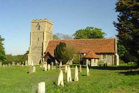
Turn left and continue to the A137. Cross carefully to Valley Lane opposite. Keep the Business Centre on your left and walk ahead along a concrete track. The track soon passes through woodland and follows a sinuous route through a smaller wood, passes a house on your right and continues to Bond Hall Farm (grid ref. TM166389). Turn left into Freston village. After 200 metres, turn left at a footpath sign and follow this narrow lane to the first junction with a pair of houses on your right. Turn right and follow this track through a to a lane (grid ref. TM170394). Turn left and continue past a church on your right. Reaching the point where the lane bends right, turn left at a fingerpost on a path into Freston Wood. The path is waymarked and is part of the Stour and Orwell Walk and after exiting the trees crosses fields to reach the B1456 (grid ref. TM173402).
Turn left and left again onto the continuing path. If time permits you can cross the road to enjoy the view of the River Orwell. The path crosses a field to reach a lane at Redgate Farm. Cross the lane to the track opposite, soon veering right to join a fenced path which leads across fields back to the start.
Other walks nearby
| Walk 2017 | Pin Mill to Shotley Gate | easy | 5.5 miles |
| Walk 1639 | Erwarton, Church End & River Orwell from Pin Mill | easy/mod | 8.0 miles |
| Walk 3642 | Shotley Gate & Ewarton from Chelmondiston | moderate | 10.6 miles |
| Walk 2096 | Alton Water, Stutton & Tattingstone | easy | 5.5 miles |
| Walk 2149 | Circuit of Alton Water | easy/mod | 7.6 miles |
| Walk 3660 | Stour Valley & Dedham from Flatford Mill | easy | 3.5 miles |
| Walk 1648 | Church End & Erwarton from Shotley Gate | easy | 6.0 miles |
| Walk 3658 | Manningtree, Flatford Mill and Dedham | easy/mod | 7.1 miles |
| Walk 3267 | Ramsholt, River Deben and Shottisham Circular | easy/mod | 9.2 miles |
| Walk 3724 | River Box from Stoke-by-Nayland | easy | 6.0 miles |
Recommended Books & eBooks
Suffolk Coast and Heath Walks
 Guidebook to three long-distance routes exploring the varied landscapes of the Suffolk Coast and Heaths AONB. The Suffolk Coast Path covers 55 to 60 miles from Lowestoft to Felixstowe. The Stour and Orwell Walk is 40 miles from Felixstowe to Cattawade near Manningtree, while the Sandlings Walk is 59 miles from Ipswich to Southwold.
More information
Messaging & Social Media
Message Walking Britain and follow the latest news.

Mountain Weather
Stay safe on the mountains with detailed weather forecasts - for iOS devices or for Android devices.