Brent Eleigh from Lavenham
Suffolk Walk
County/Area - Suffolk
Author - Lou Johnson
Length - 5.0 miles / 8.1 km Ascent - 200 feet / 61 metres
Time - 2 hours 40 minutes Grade - easy
Maps 

| Ordnance Survey Explorer 196 | Sheet Map | 1:25k | BUY |
| Anquet OS Explorer 196 | Digital Map | 1:25k | BUY |
| Ordnance Survey Landranger 155 | Sheet Map | 1:50k | BUY |
| Anquet OS Landranger 155 | Digital Map | 1:50k | BUY |
Walk Route Description
Click image to see photo description.
This Suffolk walk starts from the attractive village of Laverton and explores the countryside lying to the east. One of the highlights is the beautiful village of Brent Eleigh with its historic church. The start is Market Place in Lavenham (grid ref. TL916493) where free parking is available.
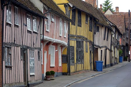
To start the walk, face the lovely half-timbered Guildhall and take Lady Street on the right of the building. Reaching a T-junction with half-timbered houses on either side, turn left into Water Street (A1141). Continue ahead passing more half-timbered properties on either side of the road. After 300 metres the road forks with a small car park on your left. Take the left-hand fork (Lower Road). Where the road bends to the left, turn right down a no through road across a small bridge.
Continue straight ahead to pass Clayhill Farm to join a tree-lined track. The track later becomes a path. Continue for just over two kilometres to reach a road (grid ref. TL943488). Turn right and go straight ahead at the next road junction to reach the entrance of The Church of St Mary on the right. A visit is recommended. Continue south along Hall Road through the village of Brent Eleigh. You soon reach a small green with a village sign. Take the lane to the right of the fine half-timbered Corner Farm to reach the A1141.
Cross the A1141 into Cock lane on the left of the small pub. After 400 metres you cross a stream where you tun right onto a signed footpath. The path continues along the edge of the field with the hedge on your right. The path swings left, passes a small lake (on your right) to reach a concrete track (grid ref. TL933476). Go straight across the track, follow waymarks through a small wood and continue along the edge of a field with the hedge to your right. The path soon runs beside more trees on your right to reach a track (grid ref. TL926477).
Continue straight ahead on a track with a ditch on your right. After 100 metres turn right up a track following an arrow and continue with hedge on left. Follow the track as it bends left and continue with the hedge now on your right. Continue to Bear's Lane Farm where the path runs to the right of the buildings to join a lane. Turn right up the lane and continue past Weaners Farm on the left. Where the road veers right by a road sign, turn left onto the signed path. After 25 metres turn right and follow a clear path that crosses a large field. Continue on a tarmac path in front of houses.
Go straight ahead on Bear's Lane and ignore all side roads on left and right. You reach a T-junction Turn right onto the B1071. Pass several half-timbered houses. The B1071 soon joins the A1141 where you continue ahead along High Street in the centre of the village. Turn right into Market Lane, to the right of a pink half-timbered house on the right, to return to the start.
Other walks nearby
| Walk 1448 | Lavenham circular from Long Melford | easy/mod | 9.8 miles |
| Walk 1445 | Historic Long Melford | easy/mod | 8.0 miles |
| Walk 1446 | Sudbury circular from Long Melford | easy | 5.5 miles |
| Walk 3245 | Woolpit and Rattelesden circular | easy/mod | 6.0 miles |
| Walk 3411 | Buxhall to Drinkstone Green | easy/mod | 7.5 miles |
| Walk 3724 | River Box from Stoke-by-Nayland | easy | 6.0 miles |
| Walk 3263 | Clare and Cavendish Circular | easy/mod | 7.7 miles |
| Walk 3660 | Stour Valley & Dedham from Flatford Mill | easy | 3.5 miles |
| Walk 3658 | Manningtree, Flatford Mill and Dedham | easy/mod | 7.1 miles |
| Walk 2096 | Alton Water, Stutton & Tattingstone | easy | 5.5 miles |
Recommended Books & eBooks
Suffolk Coast and Heath Walks
 Guidebook to three long-distance routes exploring the varied landscapes of the Suffolk Coast and Heaths AONB. The Suffolk Coast Path covers 55 to 60 miles from Lowestoft to Felixstowe. The Stour and Orwell Walk is 40 miles from Felixstowe to Cattawade near Manningtree, while the Sandlings Walk is 59 miles from Ipswich to Southwold.
More information
Messaging & Social Media
Message Walking Britain and follow the latest news.

Mountain Weather
Stay safe on the mountains with detailed weather forecasts - for iOS devices or for Android devices.