Shropshire Hills WalksWalking Routes & Hiking Trails
Find Shropshire Hills walks from the list below which features the best walking routes in the area. Most are circular walks and are listed from the shortest and easiest to the longest more challenging routes.
The best places to wslk in the Shropshire Hills AONB are listed below. The walks range from easy circular walks to more energetic routes in the hills. The hikes reach all the highest hills including Titterstone Clee Hill, Long Mynd, the Wrekin and Stiperstones ridge. In addition there are walks from Carding Mill and the list includes Wenlock Edge. All walks are free to download and print and routes have GPX files.
| Walk | Description | Grade | Miles |
|---|---|---|---|
| 3596★ | The Stiperstones from the Knolls | easy | 2.00 |
| 1009★ | The Wrekin from near Cluddley | easy/mod | 3.00 |
| 1097★ | Caer Caradoc from Church Stretton | easy/mod | 3.50 |
| 1072 | Stiperstones low level circular from Stiperstones Inn | easy | 4.00 |
| 1409★ | Haddon Hill and Bodbury Hill from Carding Mill Valley | easy/mod | 4.40 |
| 2296★ | Brown Clee Hill Circular from Brown Clee picnic area | easy/mod | 4.50 |
| 2176★ | Wrekin Circular from near Cluddley | easy/mod | 4.50 |
| 1844★ | The Portway & Betchcott Hill from Picklescott | easy/mod | 5.00 |
| 3045★ | The Stiperstones & Blakemoor Flat from the Knolls | easy/mod | 5.00 |
| 1832★ | The Hollies & Poles Coppice from near Habberley | easy/mod | 5.00 |
| 3395★ | The Stiperstones Ridge from the Knolls | easy/mod | 5.50 |
| 3334★ | Titterstone Clee Hill and Catherton Common | easy/mod | 5.50 |
| 1374★ | Lightspout Waterfall and Pole Bank from Carding Mill | easy/mod | 5.75 |
| 2395★ | Mitchell's Fold & Bromlow Callow | easy/mod | 6.10 |
| 2633★ | Brown Clee Hill from Abdon | easy/mod | 6.25 |
| 2678★ | Wenlock Edge & Broadstone from Wilderhope Manor | easy/mod | 6.40 |
| 1180★ | Pole Bank (Long Mynd) from Carding Mill | moderate | 6.50 |
| 2345★ | Clee Hills from near Cleobury North | easy/mod | 6.75 |
| 3447★ | Caer Caradoc, Hope Bowdler & Willstone Hills from Cardington | moderate | 7.00 |
| 2054★☩ | Linley Hill & Beeches from Wentnor | easy/mod | 7.00 |
| 1871★☩ | Snailbeach & the Stiperstones | moderate | 7.00 |
| 3529★ | Stiperstones from Snailbeach | easy/mod | 7.00 |
| 1907★ | Stowe & Offa's Dyke from Kinsley Wood | moderate | 7.00 |
| 2159★ | Lightspout Hollow, Pole Bank & Ashes Hollow | moderate | 7.30 |
| 2654★ | Titterstone Clee Hill & Cleeton St. Mary from Cleehill | moderate | 7.50 |
| 3422★ | Ratlinghope & the Stiperstones from the Knolls | moderate | 7.50 |
| 1785★ | Newcastle on Clun circular | moderate | 7.50 |
| 2022★ | Wenlock Edge & Aston Munslow | moderate | 7.75 |
| 3631★☩ | Panpunton Hill & Stowe from Knighton | moderate | 7.80 |
| 1203★ | Stokesay Castle & View Edge | moderate | 8.00 |
| 2471★ | Clun Valley Circular | easy/mod | 8.10 |
| 2083★ | Linley Hill and Linley from The Bog | moderate | 8.50 |
| 2745★ | Betchcott Hills & Pole Bank from Bridges | moderate | 9.00 |
| 1809★ | Shelve & the Stiperstones from The Bog | moderate | 9.00 |
| 1321★ | Caer Caradoc & Hope Bowder Hill from Church Stretton | moderate | 9.00 |
| 1205★☩ | Adstone Hill, Medlicott and the Long Mynd from Bridges | moderate | 9.50 |
| 3048★☩ | Caer Caradoc & The Lawley from Church Stretton | moderate | 10.00 |
| 3308★☩ | Ragleth and the Long Mynd from Cardingmill Valley | mod/hard | 11.00 |
| 3050★☩ | Clun circular | moderate | 11.50 |
| 2816★☩ | Kinsley Wood, Stowe and Offa's Dyke | moderate | 12.00 |
| 3449★☩ | Ragleth, the Long Mynd & Ratlinghope from Carding Mill | hard | 18.00 |
★ GPS file ☩ Route profile
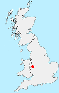
Location Map
Shropshire Hills Guide
This National Landscape (formerly AONB) consists of a number of areas of hills centered on Church Stretton. The hills are known for the variety, extensive network of paths and wonderful scenery. The most popular hills are the Long Mynd but others including Wenlock Edge, the Stiperstones and those around Clun are also gaining in popularity.
Shropshire-Hills Walking Guide
Other walks in Britain - For a list of all the areas where walks are available go to the Main Walk Index.
Walk grading - Learn how each walk is assessed and select a walk to suit your ability and experience by going to Walk Grading Details.
Messaging & Social Media
Message Walking Britain and follow the latest news.

Mountain Weather
Stay safe on the mountains with detailed weather forecasts - for iOS devices or for Android devices.